
Friday, July 24, 2009
Highway 231, Wyoming
On the way from
Medicine Lodge Archeological Site to
Legend Rock Petroglyph Wall
We are happy to be on a paved rode after Mr. Garmin (the GPS) took us onto tertiary roads in the Wyoming minefields yesterday. We were driving from Ten Sleep to Hyattville and we knew it would be gravel for 9 miles but Mr. Garmin wanted us to take State Road 117, which was a set of deep ruts in red clay. A fellow in the campground in Milwaukee had been through minefields when he go misguided in the same zone but we wandered through a Wildlife Management Area with a deep river and lush marsh. We’ve seen oilrigs and evidence of mining but happily we have not seen the open pits and slag heaps, which were such a part of back road Pennsylvania
If you want to go to Medicine Lodge you just have to believe you will get there. If you call ahead you get an answering machine with no useful information. The Wyoming 1-800-Camping said there were no reservable sites remaining for the next two weeks so have a back-up plan for camping. There were No Signs except things such as “Archeological Site, 0.5 miles) . The postmistress at Hyattville (population 46) gave excellent directions (take the Alkali road but don’t continue if it goes to hard dirt.) We arrived for lunch and immediately hung the hammock chair on a small cottonwood by a rushing stream in a narrow canyon. We ate lunch and then followed the waterway toward the main campground where we found a swimming hole made when the rushing stream hit a sandstone cliff face. The water was deep and completely clear and 58 degrees. It was delicious.
After another swing in the hammock chair we continued up the stream, into the box canyon and backwards through the interpretive trail, past similar encampments along red cliffs with swim holes and flat river bottom campsites. We saw an oriole.
The canyon ends at a red sandstone cliff wall, which has been continuously occupied for the last 10,000 years. The most recent 4,000 years was scraped off by the Taylors who built the luscious grand farmhouse, which still stands and also donated 12,000 acres of ranch to posterity.
At the final red rock cliff at the along the canyon there are 100s of petroglyphs and pictograms.We had waited for late afternoon and it was wonderful to see them incised in the walls so carefully and so detailed. The pictograms are very hard to discern but the petroglyphs are astounding in both their clarity and their ability to evoke the artist’s presence. One is huge – round shield hunters whose arrows are deeply embedded in a fat antlered animal (an elk).There was a petroglyph grasshopper! I got to draw a lot of nice pictures.
After our reverse interpretive hike we decided to move our campsite to the swim hole by the red cliff wall. We watched fish jump out of the water and eat bugs while we ate our dinner. I liked the idea that I was camping where people had been camping for 10,000 years. We saw a muskrat or some similar animal swim along the red cliff wall and out the other side of our little swimming hole in the mid-evening. After dinner we did hike up on top of the red cliffs and out onto the back plateau of the riverbed. There were a lot of mule deer unafraid of us.
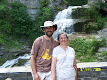
This is the swimming hole we camped next to.


No comments:
Post a Comment